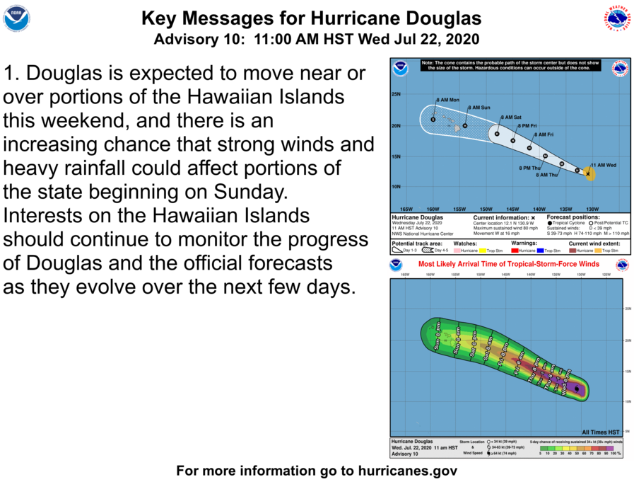
Hurricane Douglas is located near 12.1N 130.9W at 2100 UTC, andis moving to the west at 14 kt. Estimated minimum central
pressure is 989 mb. Maximum sustained winds are 70 kt with gusts
to 85 kt. Numerous moderate to strong convection is from 10N-
13N between 129W-133W. Scattered moderate isolated strong
convection is elsewhere from 05N-15N between 126W-134W. A turn
toward the west-northwest is expected by this evening, and a
west-northwestward motion at a faster forward speed is forecast
to continue into the weekend. Additional strengthening is
forecast during the next day or two, and Douglas could become a
major hurricane on Thursday.


