
HAWAIIAN VOLCANO OBSERVATORY STATUS REPORT
U.S. Geological Survey
Wednesday, December 7, 2022, 4:23 PM HST (Thursday, December 8, 2022, 02:23 UTC)
MAUNA LOA (VNUM #332020)
19°28’30” N 155°36’29” W, Summit Elevation 13681 ft (4170 m)
Current Volcano Alert Level: WARNING
Current Aviation Color Code: ORANGE
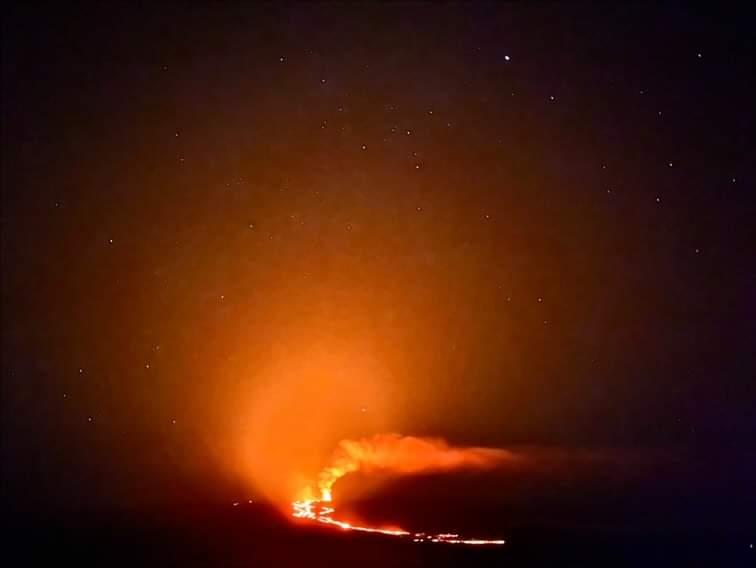
The Northeast Rift Zone eruption of Mauna Loa continues. One active fissure, fissure 3, is feeding a lava flow downslope.
Fissure 3 is generating a lava flow traveling to the north toward the Daniel K. Inouye Highway (Saddle Road) that has reached relatively flatter ground and slowed down significantly, as expected.
The lava flow has advanced very little since 6:00 a.m. this morning, December 7, when it was about 1.8 mi (2.9 km) from the Daniel K. Inouye Highway (Saddle Road). The flow advance has slowed possibly due to a significant breakout removing lava from the channel about 2.8 mi (4.5 km) behind the tip of the main flow on the east side. The main flow has advanced at an average rate slower than 20 feet (6 meters) per hour during the 24-hour period prior to this morning. The lava flow remains active and is continuously supplied from the fissure 3 vent. HVO crews have installed a new webcam to view the front of the main flow https://www.usgs.gov/observatories/hvo/m9cam-mauna-loa-fissure-3-eruption-northeast-rift-zone
Lava flow advance rates may be highly variable over the coming days and week. Lava flows advance more slowly, spread out, and inflate on the flat ground between Mauna Loa and Mauna Kea. Individual lobes may advance quickly, and then stall. Additional breakouts may occur if lava channels get blocked upslope. There are many variables at play, and the direction and timing of flow advances are expected to change over hours to days, making it difficult to estimate when or if the flow will impact Daniel K. Inouye Highway.
Sulfur dioxide (SO2) emission rates of approximately 120,000 tonnes per day (t/d) were measured on December 4, 2022, and remain elevated at this time. Volcanic gas is rising high and vertically into the atmosphere before being blown to the west at high altitude, generating vog (volcanic air pollution) in areas downwind. The Hawaii Interagency Vog Information Dashboard has detailed information about vog: https://vog.ivhhn.org/. Forecasts for the dispersion of vog can be found on the VMAP Vog Forecast Dashboard: http://weather.hawaii.edu/vmap/new/.
Pele’s hair (strands of volcanic glass) fragments are being wafted great distances and have been reported as far Honoka‘a.
Tremor (a signal associated with subsurface fluid movement) continues beneath the currently active fissure. This indicates that magma is still being supplied to the fissure, and activity is likely to continue as long as we see this signal.
There is no active lava within Moku’āweoweo caldera nor the Southwest Rift Zone. We do not expect any eruptive activity outside the Northeast Rift Zone.