
HVO/USGS Volcanic Activity Notice
Volcano: Mauna Loa (VNUM #332020)
Current Volcano Alert Level: WARNING
Current Aviation Color Code: ORANGE
Previous Aviation Color Code: RED
Issued: Sunday, December 4, 2022, 8:10 AM HST
Source: Hawaiian Volcano Observatory
Notice Number: 2022/H628
Location: N 19 deg 28 min W 155 deg 36 min
Elevation: 13681 ft (4170 m)
Area: Hawaii
Volcanic Activity Summary:
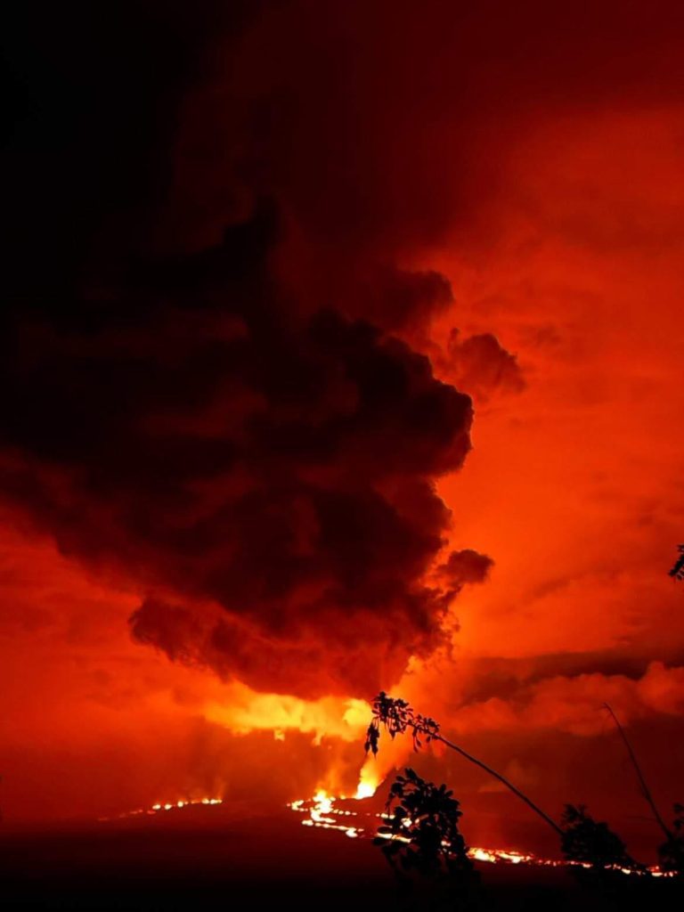
Lava eruption from fissure 3 on the Northeast Rift Zone of Mauna Loa continues, but the threat to aviation of significant volcanic ash emission into the atmosphere has passed. For this reason, HVO is reducing the aviation color code from RED to ORANGE.
The ground-based volcano alert level will remain at WARNING, reflecting the ongoing hazards of the fissure 3 lava flow. Lava flows are slowly moving north toward Daniel K. Inouye Highway and are spreading out and inflating (thickening) as they advance over low-sloping ground. The fronts of lava flows can break open unexpectedly, sending flows in several directions. Rain on lava creates steam and reduces visibility. If visiting the County of Hawai’i public viewing area, remain with your vehicle and do not approach the flows.
The Federal Aviation Administration has issued a temporary flight restriction extending from the surface to 1500 feet (457 meters) above ground level in the eruption area. See: https://tfr.faa.gov/save_pages/detail_2_9210.html
THE ERUPTION OF MAUNA LOA CONTINUES ON THE NORTHEAST RIFT ZONE WITH ONE ACTIVE FLOW. THE LEADING EDGE OF THE LAVA FLOW CONTINUES TO HAVE MINIMAL MOVEMENT AND REMAINS NEAR THE 7,000 FT ELEVATION AND MORE THAN 2.7 MILES AWAY FROM DANIEL K. INOUYE HIGHWAY. IT DOES NOT POSE A THREAT TO ANY COMMUNITIES AT THIS TIME.
DANIEL K. INOUYE HIGHWAY IS OPEN IN BOTH DIRECTIONS. DUE TO VEHICLE CONGESTION ON DANIEL K. INOUYE HIGHWAY, EXPECT AND PLAN FOR DELAYS BETWEEN THE 28-34 MILE MARKERS. SPEED LIMIT NEAR THE MAUNA KEA ACCESS ROAD AND THE GILBERT KAHELE RECREATION AREA HAS BEEN REDUCED TO 35 MPH.